
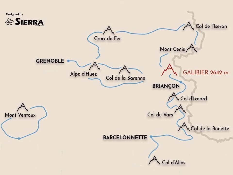
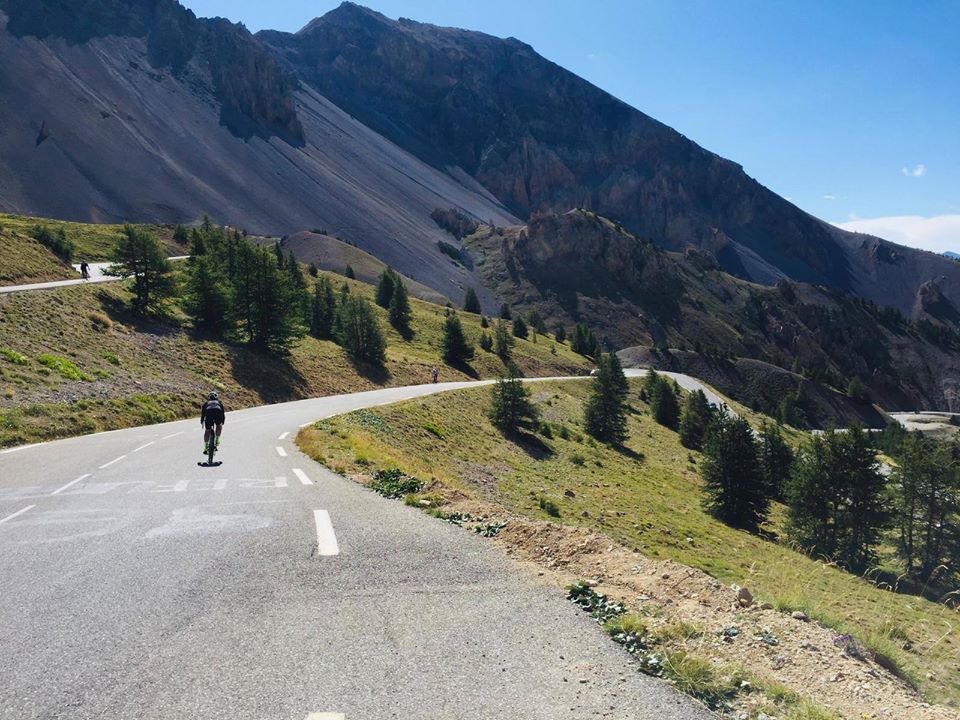
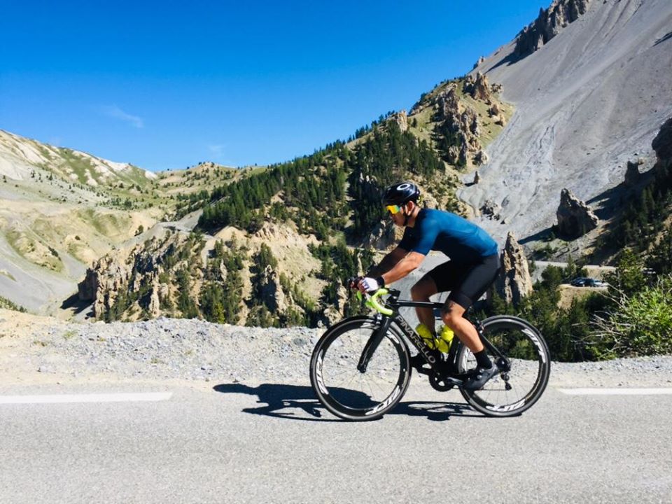
The Alps are a vast European mountain range found in the south east of France. Most recreational cyclists dream about cycling the French Alps at least once in their lifetime! The French Alps dominate the Rhone-Alpes and Provence-Alpes-Cote d’Azur regions. Some of the ranges are entirely in France while others are shared with Switzerland and Italy.
You have probably heard of the Maurienne valley and Oisans valley. These two valleys provide access to dozens of epic cols which are within cycling distance each other. This ‘Cycling the French Alps’ guide focuses on many of the famous climbs between Alpe d’Huez and Mont Ventoux.
In this blog we share our road cycling knowledge and offer suggestions on the famous ‘cols’ on offer. Lesser known cycling climbs that you should have on your radar are also covered. We also discuss where to start your French Alps cycling holidays with options on where to base yourself. A number of our favourite cycling the French Alps routes have also been prepared.
Contents
- 1 Classic Cols when cycling the French Alps
- 2 Where to Start Cycling the French Alps
- 3 Cycling Routes & Where to Stay in the French Alps
- 4 Final Words from Cycling the French Alps
- 5 Additional Cycling Blogs
Classic Cols when cycling the French Alps
Here we present what we believe are the top French Alps bucket-list climbs in the Rhone Alps and Provence-Alpes-Cote d’Azur regions. We have been lucky to ride these climbs consistently over the last decade. Between our own experiences and feedback from guests it has become clear that these are the best challenges when cycling the French Alps! So here we go in no order of particular preference. Cycling the French Alps has never been easier! Choose from Alpe d’Huez, Col de la Croix de Fer, Col du Galibier, Col de l’Iseran, Col d’Izoard and Mont Ventoux.
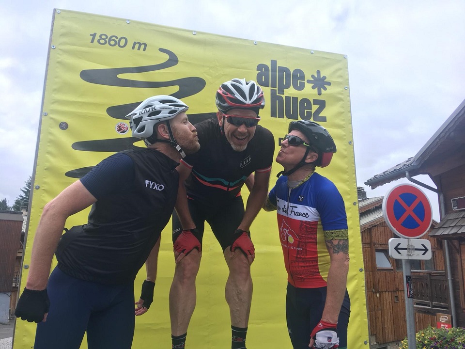
Alpe d’Huez
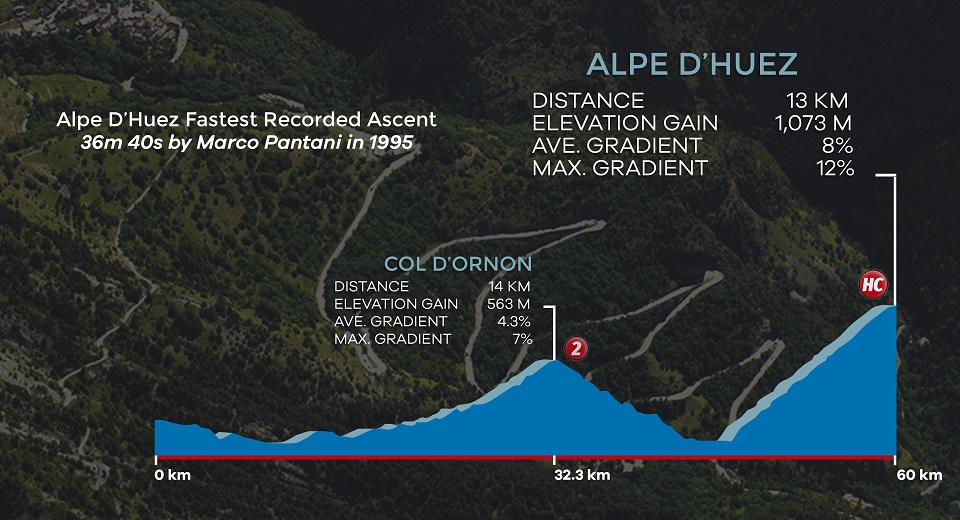
Alpe d´Huez and its famed 21 switchbacks. No other mountain has had so much Tour de France drama. With the number of roadside spectators over the years it is easy to call it the Hollywood of French cols. Switchback seven, otherwise known as Dutch Corner, is probable etched into your mind with the splash of orange found during Le Tour. However, with or without the TDF, the atmosphere on the mountain is always fantastic. 13km at 8% average grade will be a constant test!
History of the 21 bends
The excitement on the mountain has grown exponentially since the 1980s. Up until the early 1950’s Alpe d’Huez was simply a primitive ski resort (2 or 3 hotels) with a potholed road leading to the top. Hard to believe right! Especially considering that it has now 30 Tour de France stage finishes making it centre stage for many famous battles.
Going back to 1952 and Fausto Coppi won the first ever summit finish attacking with 6km to the summit. Coppi was fourth overnight and 5 minutes down on the general classification. Following the inaugural Huez summit he found himself sitting with the race lead. Not a bad day’s work by Coppi who was definitely at the peak of his powers during the early 1950’s. Thanks to some high-profile local businessmen a big pot of money was paid to the TDF organisation for the 1952 Stage 10 finish.
Surprisingly it took another payment, again from one of the original backers, before the race returned to the 1976 Alpe d’Huez. A 24 year hiatus which again saw two riders go head to head all the way to the top. Another incredible spectacle whcih thankfully now sees the race frequently return to the famous 21 bends.
Getting Started on Alpe d’Huez
To conquer this TDF summit finish get yourself organised in the town Le Bourg d’Oisans. Especially if you need to find yourself a hire bike. From there you can get started to enjoy the switchback countdown. Each of the 21 hairpin bends has been named after past stage winners and you too will soak up all the history! Pacing the first km is pretty important as its 10.5% average grade often puts recreational riders away too early. It is just so difficult to not get caught up in the moment! We understand.
What’s a good time up Alpe d’Huez?
We often get asked about what’s a good time to the top? Before this can be answered it will depend on where you choose to stop. In the town shopping area or at the official Le Tour race finish line? If you are riding with others we would say your best bet is to finish in the town shopping strip. Before the left sweeping underpass where you can wait for everyone to regroup.
That way no-one will get lost and you will have time to look through the shops and souvenir hunt. Once re-grouped you can pose on the makeshift podium before riding the final kilometre to the official race finish line. Please note – if a rider gets it really wrong they just might keep pedalling another 5km or so all the way up to Lac Besson. This is not a problem for mountain goats who love to climb all day (in fact it is highly recommended). But if you were already at your limit passing through the village (12km) then stopping here will be the best option. We know of this happening and riders cursing about how they ended up at the lake!
Now getting back to the point! Coppi’s 1952 time was 45min 22sec. EPO boosted times we understand went as low as into the 36min mark territory. We would have to say that anything around 1hr 15min for a recreational rider is a very good time.
Please note that there are a couple of other road cycling approaches to reach the Huez ski village and these are presented later in the ‘Cycling Routes & Where to Stay’ section.
Col de la Croix de Fer
This legendary climb is located in the heart of the Maurienne valley. Its elevation is 2067m so it’s typically one of the earliest climbs to open in the French Alps. Other climbs such as Galibier and Iseran top out at 2600m plus. The standard iron cross monument at the top is the perfect place for a keepsake photo. In 2016 this was vandalized so it is a good thing that it is back up there adding to the cycling experience.
From the top there is Alpe d’Huez to the south, Galibier to the east and Madeleine to the north. Talk about the perfect climb for cyclists to link between the Maurienne valley and Oisans valley.
Croix de Fer at Le Tour
This famous climb was first used during the 1947 Tour de France. To emphasize its link road nature Col de la Croix de Fer has never been used as a stage summit finish. It has been used on 19 occasions but always providing access from one valley to another. This really surprises us because we have seen plenty of other TDF summit finish locations with much less space at the top. For instance, we would love to see a Tour de France stage which includes Col de la Sarenne to the top of Alpe d’Huez. Then down to Allemont (various options available) and up Col du Glandon with an epic summit finish on Croix de Fer.
Cycling up to the ‘Cross’
There are five main routes to get to the top and in many cases you can be rewarded with Col du Glandon and/or Col du Mollard as well. Now that is what we call efficient cycling col hunting! Our favourite Croix de Fer approaches are listed here:
- From Allemont it is 24km at 5% average grade first ascending Col du Glandon (21km). At Col du Glandon turn right and ride the final 3km to Croix de Fer. It is a difficult climb which should not be underestimated as a number of short downhill sections misrepresent the average grade. There are maximum biting uphill gradients of 11%! Cycling from Allemont follows a profile awhich we believe is very similar to Mount Hotham in the Victorian High Country.
- From St Jean du Maurienne one is confronted with a 29km at 5% average grade climb. Without analyzing all the TDF crossings to date we would have to think that this is the favourite wheel path of Le Tour. Really it is not until you leave the St-Sorlin-d’Arves ski village that things become too complicated though. From here on the road narrows, the switchbacks set in and the road ramps up for a final 6km test to the summit.
- From Saint-Etienne-de-Cuines the climb measures 22km at 7% average grade. Officially you have started on Col du Glandon where the early kilometres pass a thick forest with fresh stream crossings before a wild switchback finish. Just quietly but this is one of our favourite places for cycling photography! At the Col du Glandon summit veer left and now the Croix de Fer summit is in sight. Here is your chance for the final 3km kick to the summit.
Col du Mollard variation
Col du Mollard is another variation that can be added to your Croix de Fer route. If you are looking to spice up your ride start descending Croix de Fer towards St Jean du Maurienne on the D926 road. After 14km of descent turn off to the right at Barrage de Belleville onto the D80 and the Col du Mollard signpost. Col du Mollard offers a further 6km of climbing (404m elevation gain at 6.7% average grade). The final 13.5km descent includes a packed finale of hairpin corners down to the Maurienne valley floor at Villargondran. At the base you are now only a few km to St Jean du Maurienne. Be sure to go back to your Garmin for the official hairpin descent count!
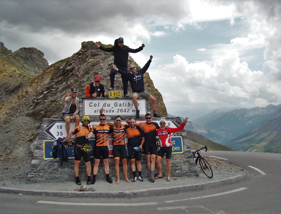
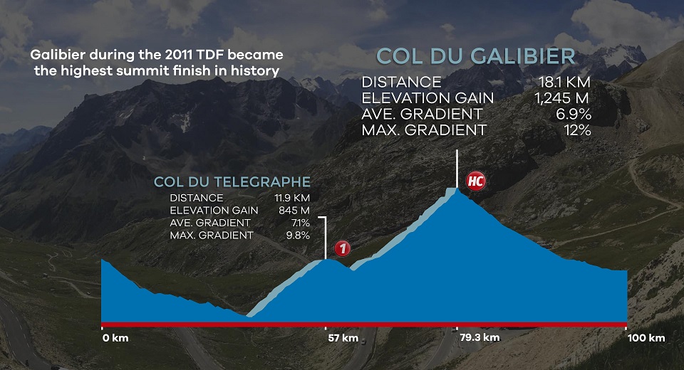
Col du Galibier (north side)
The Galibier peak stands at 2640m and to date is the highest mountain used for a TDF stage finish. Just quietly but Col du Galibier has a total of 59 magical Tour de France moments!
One kilometre from the summit is the single lane 355m tunnel. As a cyclist make sure to detour the tunnel and take the paved road all the way to the top. This applies for both sides of the tunnel. On the southern side of the tunnel there is a monument dedicated to the father of the Tour de France, Henri Desgrange. The souvenir Henri Desgrange is the prize awarded for the first rider that passes the highest elevation during any Tour de France edition. When Col du Galibier is included in the race it usually takes this prize easily and double king of the mountain (KOM) points are awarded!
Galibier at the 1911 Tour de France
Looking back to some Tour de France history and it was in 1910 that the first Pyrenean climbs were successfully introduced to the race. Subsequently the much higher Alps were introduced the following year. In 1911 a 266km stage included the inaugural crossing of Col du Galibier. You might remember that in 2011 they climbed Galibier twice to celebrate the 100th anniversary of its first crossing! Talk about punishment. The second time up was the first ever and still only Tour de France summit finish which was won by Andy Schleck.
Nowadays it is the total length of the climb rather than the grades which affect most recreational cyclists. One needs to remember though that since the first TDF warriors the roads have been regraded for the better and asphalted. What it must have been like a century ago scaling to these heights on inferior bikes!
Giro on the Galibier
The Giro d’Italia even organized a Galibier stage finish during Stage 15 of the 2013 race. This was quite a risky proposition during the month of May and as such the stage finish on this occasion was set 4km down from the summit at the Marco Pantani memorial. Their plan worked as the weather held off at this 2295m elevation and Giovanni Visconti took the chocolates! The Pantani memorial sets the location where Italian rider attacked in the rain to secure victory in the 1998 Tour de France.
How to access the Galibier
The Col du Galibier summit can be accessed from the Maurienne valley leaving Saint Michel du Maurienne. The summit of Col du Lauteret (main road that links Briancon with Le Bourg d’Oisans) is another access point. It is from the bottom of the valley in Saint–Michel–du-Maurienne where the authentic Tour de France double awaits: Telegraphe (12km) followed by Col du Galibier (18km)! It is often a good idea to break up the ride with a stop in the ski village town of Valloire. Valloire is neatly and strategically placed between these two epic cols:
- Col du Telegraphe: 11.8km long, 856m elevation gain, 7.3% average grade
- Valloire ski village
- Col du Galibier: 18km long, 1245m elevation gain, 7% average grade
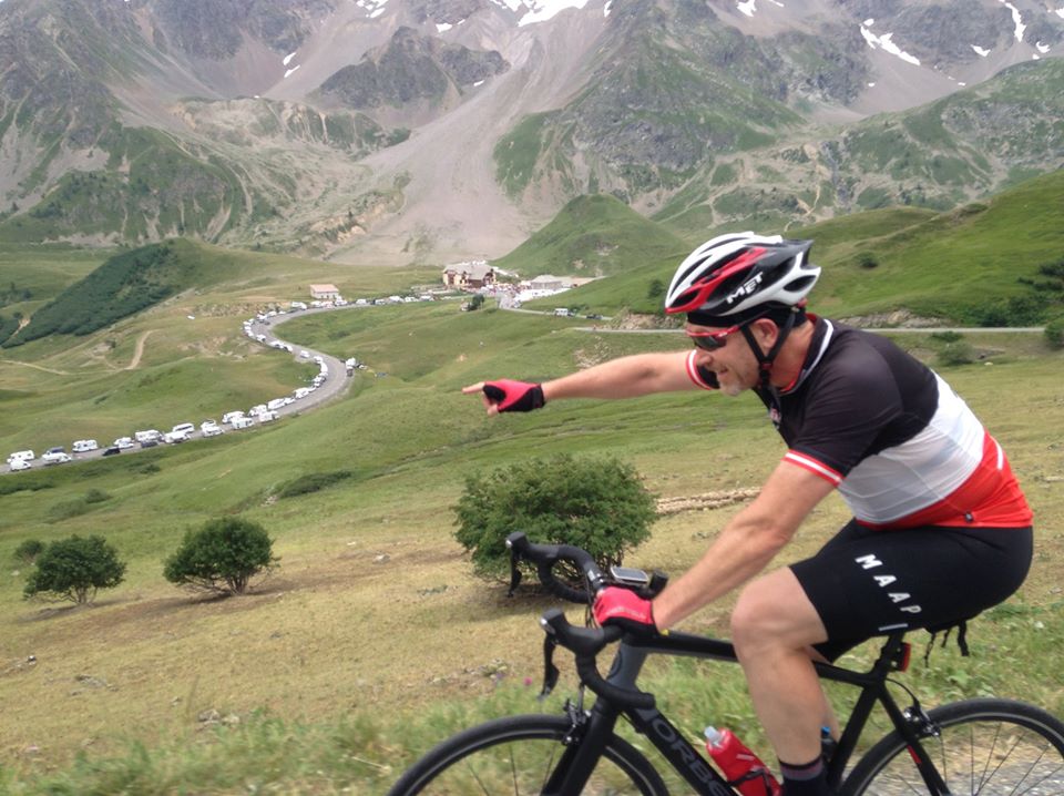
After Valloire there is quite a long straight section which is mentally tough. As you struggle with the grades it seems you are just not getting anywhere. Usually with the switchbacks you can at least see the prize at the top. When you arrive at Plan Lachat one starts to feel more confident that you might actually reach the summit. The final 8km above Plan Lachat is what you will hear everyone talk about. 8km of never-ending switchbacks to cycling glory!
Most of our clients who complete the Telegraphe / Galibier double refer to it as their hardest yet most rewarding day of cycling.
Col du Galibier (south side)
From the summit of Col du Lauteret it is also an amazingly beautiful ride to the top of Galibier. Technically this southern Galibier approach belongs to Provence-Alpes-Cote d’Azur region of the French Alpes.
As you pedal along it is as if a spell has been cast over you. All you want to do is watch the scenery below rather than concentrating on the twisting roads ahead! This Galibier ascent is even better when you climb in this direction the day before the Tour de France. The vantage point over the Col du Lauteret road is exceptiona. The never-ending line of caravan city below is to be seen to be believed!
If you are new to cycling and want to achieve something magical than start at the summit of Col du Lauteret. Here it starts at 2058m elevation which is a good help and only 8km to the Galibier summit! We would advise against riding from Le Bourg d’Oisans to get both Col du Lauteret and Galibier. There are too many tunnels in our opinion. But at the end of the day this will come down to everyone’s personal risk profile. In contrast, from Briancon to the summit of Lauteret there are no closed tunnels. One can usually find another space/shoulder to feel relatively comfortable.
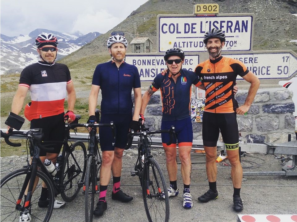
Col de l’Iseran (south side)
The mighty Col de l’Iseran rests at a staggering 2770m elevation. It is hidden a little out of the way so it’s not always included in cycling the French Alps programmes. This giant col is ranked number 1 on the list of Europe’s highest asphalted passes. However, it has only been scaled on nine occasions during the Tour de France. The last time was during Stage 19 of the 2019 edition when hail and ice in Tignes caused a mudslide. It was impossible for the peloton to ride to the stage finish! Luckily for Egan Bernal he made an early attack on Col de l’Iseran and put some time into Alaphilippe.
The options for scaling Col de l’Iseran are from Bourg Saint-Maurice and Lanslebourg / Modane. Technically, from Bourg Saint-Maurice the north approach is located outside of the blog titled region. It is a 46.9km, 2045m elevation gain and 4.2% average grade kind of ride. However, the first 30km from Bourg to Val d’Isere are on a busy rather non-interesting kind of road and some fairly dark tunnels near Tignes. Just for your information, the final 17km to the summit from Val d’Isere average around at 6%.
Sierra’s preferred ascent
Our preferred option for cycling Col de l’Iseran is from Modane / Lanslebourg (south approach). We often take our time and ride from Modane when tackling Col de l’Iseran. From Modane the climb measures 48km with an average 4% grade:
- KM 0 – 9: a very accommodating 1-2% average grade
- KM 9 – 24: constant climbing which ranges between 4-7%
- KM 24 – 33: easy 1-2% average grade
- KM 33 – 48: constant 6% average
To be honest though it is really only the final 12-13km where the feeling of riding an epic mountain road takes shape. From here switchbacks, rock carved tunnels and glaciers are all around. With the mudslide during the 2019 TDF edition the mountain pass was quickly closed to traffic. The local emergency services had created a temporary road block about 7km to the Iseran summit. We were on our bikes and politely asked the roadside authorities if we could simply continue to the summit and then return straight back down.
2019 TDF on Iseran
Based on our experience with the French police (Gendarmarie) we did not hold our hopes high. But we were given, to our surprise, the green light to proceed. And what an opportunity it was! Here is a link to our short blog post ‘A Moment on Tour´. In summary though our cycling tour group cycled in solitude to the top of the mighty Col de l’Iseran. Probably the best bit though was enjoying a car-free descent. Cycling like the pro’s for 1hr on Europe’s highest mountain pass where the 2019 TDF had just been won moments earlier was something magical!
Final thoughts – if given the option our pick would be to ride from Modane or Lanslebourg anytime. When you start all the way down in Modane it is also straightforward to select parallel roads that take you over smaller cotes such as Aussois even before arriving to Lanslebourg.
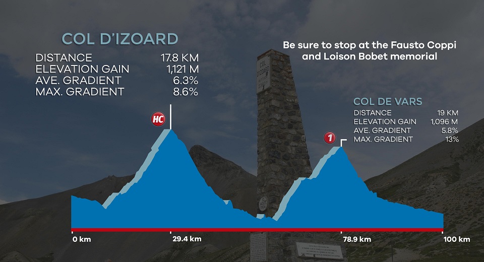
Col d’Izoard
Any cycling outing that includes Col d’Izoard is yet another classic Tour de France route. For many the ´Izoard´ (2360m) and its sandy eroded cliffs above la Casse Deserte resemble an amazing lunar landscape. The 35 TDF crossings have provided many an iconic black & white photo of the race!
The race to the summit was first included during the 1922 Tour de France. It was during the late 1940s / early 1950’s (in the Giro & TDF) where its name was etched into cycling folklore. There were so many special moments thanks to riders such as Fausto Coppi and Louison Bobet. Solo breakaways and cycling heroics was the call of the day. Today there is a special monument to these two riders in the Casse Deserte. Follow this link to our ‘Giro d’Italia – A Trip Down Memory Lane‘ blog to find a photo of this special monument. You can also read about Coppi’s exploits on Col d’Izoard during Stage 17 of the Giro 1949. The stage between Cueno to Pinerolo was a Solo Victory for the Ages.
Five Giro visits to Col d’Izoard
Being located so close to the Italian border means other special Giro d’Italia moments have also been celebrated. The Giro has crossed Izoard during 1949, 1964, 1994, 2000 and 2007. A fantastic day on the mountain was also experienced during the 2017 La Course. The TDF organisers took the women’s race away from the Champs Elysees to the heights of Col d’Izoard. Van Vleuten was the winner on the day as she has been so often the case already in this interrupted 2020 season. Warren Barguil is also the only male rider who can proudly say he has won a Col d’Izoard stage summit finish.
In order to conquer Col d’Izoard it can be ridden from its south or north side:
- Traditionally the toughest climb and most used during the Tour de France is from the Guillestre direction (south side). This ascent includes 16km, 1095m ascent and a 6.9% average. If you decide to head-off from Guillestre then you now have a 30km climb to contend with. 14km of pedal power is required up the D902 gorge road against the grade of the River Guil.
Beware of the Gorge Road
[If you know the Col du Tourmalet in the French Pyrenees you will know the Gorge de Luz road up to Luz St Sauveur. It seems like a gentle, friendly valley road but many Tourmalet assaults are over before they even begin. This is simply because the gorge road is pushed too hard].
Like the Tourmalet the same applies to Col d’Izoard when started from Guillestre. Be sure to also pray for no headwind! Now that you are on the climb there are many 8-10% sections during the initial 7km. This lower part of the climb is relatively open with long stretches. From around 1800m elevation the fun begins as the switchbacks arrive.
Izoard and the Casse Deserte
With approximately 3km to the summit the climb enters the unique landscapes of the Casse Deserte. Eroded cliffs, rock pinnacles and stunning valley views all surround. Pro-riders tell tales of only realizing how beautiful the Izoard landscapes are in retirement. You need to slow down and stop to take it all in!
- From Briancon the climb is closer to 20km, 1141m ascent and 5.7% average grade. This northern approach is the climb that we normally use. We prefer to stay in Briancon and surrounds when cycling in this part of the alps. It is a relatively easy beginning up to the Cervieres village (10km). The final 6km towards the summit includes about a dozen switchbacks with wide open views and beautiful scenery. Descending down the south side and then flying down the gorge to Guillestre is a highlight. If you are feeling really strong then you can also tackle Colle dell’Agnello from the base of Izoard.
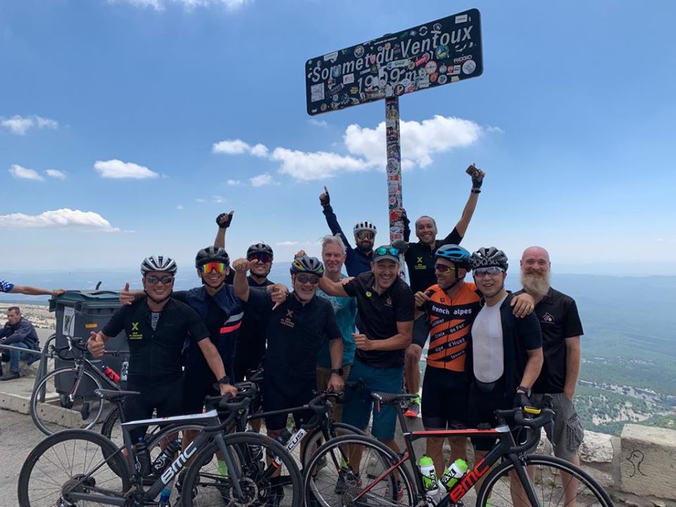
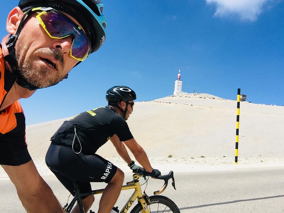
Mont Ventoux (still cycling the French Alps)
Mont Ventoux has celebrated 10 spectacular TDF finishes on what is a ‘bald’ limestone, windy and moonscape-like summit. The mystique of the mountain has grown over the years. There was death with Tom Simpson. Then there were unlikely heroes like Eros Poli. Race fixing allegations (Pantani/Armstrong) and doping scandals (Richard Virenque) surrounded. More recently there has even been comedy. Who remembers Chris Froome running with no bike during the 2016 TDF?
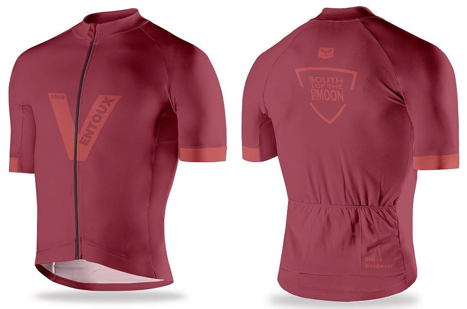
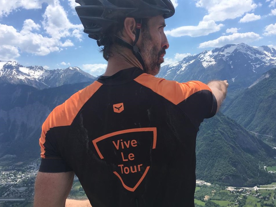
Lacking surrounding mountains, Ventoux, is still surprisingly for some a part of the French Alpes. It can be climbed from Bedoin, Malaucene or Sault. The three ascents range between 22km and 26km and vary in difficulty. The southern approach from Bedoin is the most famous TDF ascent and the inspiration for our ‘South Side of the Moon’ slogan. This slogan is on the back of our exclusive Ventoux cycling jersey. V is also for Victory and scaling the ‘Geant du Provence’ will be one of your greatest cycling accomplishments!
Mont Ventoux in numbers!
Here is a glimpse of what to expect on Ventoux when cycling from Bedoin. The famous route straight from the Tour de France now awaits.
- KM 0 – 6: 4% average grade up to the famous St Esteve bend
- KM 6 – 15: the feared forest with constant climbing always touching 9 – 10%
- KM 15 – 21.4: the lunar landscape above Chalet Reynard at 8% average grade
From Bedoin the early kilometres up Ventoux are quite easy cycling past vineyards. Here you can still keep an eye on the prize being the iconic summit weather station. On reaching the St Esteve bend you enter the ‘forest’ and things do not let up for nearly 10km. Rejoice on arriving at Chalet Reynard where you can catch your breath. From here the average 8% now feels flat unless you are unlucky to be hit by strong winds on the exposed white cliffs.
Be amazed as every pedal stroke now reveals the lunar landscape towards the summit! Now it is not the time to compare yourself against the pro’s who typically need 60 to 75 minutes to climb Ventoux. Your aim should be to get to the top and enjoy the incredible views from the iconic weather station. Plus remember to sample plenty of the sweets and dried fruits from the stalls at the summit.
Ventoux and its lunar landscape
The moonscape above Mont Ventoux rivals that of the Casse Deserte on Col d’Izoard. With only rocks all the way to the summit it feels remote and wild. What better place for a road cycling challenge! Le Geant du Provence towers over the surrounding terrain and the bare limestone cliffs resemble all-year round snow on the summit.
If scaling it once wasn’t enough than why not attempt joining the prestigious “Les Cinglés du Mont Ventoux” group of cyclists. To join the Cingles club you will need to ride to the summit from Bedoin, Malaucene and Sault all in the one day (137km and 4400m of elevation gain. Start pedalling!
Where to Start Cycling the French Alps
Grenoble (France)
Grenoble is a favourite location when it comes to cycling the French Alps. Looking for a quick fix of ‘cols’? Or looking to cross the French Alps? Either way this city will probably be your best bet. It is considered by many as the French Alps capital. The Fort de la Bastille sitting high above the city centre provides an amazing backdrop.
The town is surrounded by inspiring mountain peaks which will have you all itching for some cycling action. From Grenoble some of the biggest road cycling household name climbs are all only a short drive away. Alpe d’Huez, Col de la Croix de Fer, Col du Glandon, Col de la Sarenne and Col d’Ornon are all within 45min drive. Here you will have the car parked, bike prepared and be out on the road cycling in around an hour!!
So if ticking off Alpe d’Huez is your main aim why not hire a road bike for the day and get cracking. Col du Lauteret, Col du Telegraphe and Col du Galibier are 1hr 30min drive away. A 2hr drive gets you to the base of Col d’Izoard if this is your dream French Alps cycling destination.
Simply catch a fast train (TGV) from Paris and in 3hr you will be in central Grenoble. Alternatively, fly into Lyon Exupery Airport and there are trains leaving on the hour to Grenoble (just over 1hr travel time).
Geneva (Switzerland)
Geneva is a perfect starting point for road cycling adventures in and around Chamonix, Lake Annecy and the Swiss Alpes. This ‘Cycling the French Alps guide’ does not cover any of these regions but you can click here for our Lake Annecy cycling tour travel suggestion. Coming through Geneva is still a very good option for accessing a grand selection of French Alps cycling routes.
From Geneva it is only a 1.5hr drive to Grenoble or La Chambre / St Jean du Maurienne. We have already mentioned the road cycling climbs around Grenoble but by detouring towards La Chambre fantastic rides through the Maurienne valley open up. These include the climbs of Col du Glandon, Col du Mollard, Col de la Croix de Fer, Col de La Madeleine, Lacets de Montvernier, Col du Chaussy, Col du Telegraphe and Col du Galibier.
One thing to consider if driving in Switzerland and making border crossings into France is the compulsory 50 Euro Switzerland road permit (prices during 2016/2017). At the border you may get stopped and asked to present your Swiss permit. It is valid for 12 months and we have had to pay this a couple of times. Quite a payment if you only enter Geneva for 30 minutes to collect clients and head back inside France.
Fly into Geneva and within 10 minutes driving you are already at the French border. There are also direct train services running between Geneva and Grenoble (2-2.5hr travel time).
Turin & cycling the French Alps
From Turin (Italy) you are only a 1hr 30min drive to the base of the Sestrieres climb. Usseaux is a good starting point to ride Sestrieres which is a well-known ski village. The village is used by many Italian sporting teams for altitude training camps. UAE cycling team was also there in July 2020. During July 2016 we saw Team Sky also preparing selected riders for the second half of the European cycling season.
Once over the ‘Sestrieres’ Giro d’Italia climb, descend down to Cesana Torinese and you are right on the Italy/France border. Climb into France over Col de Montgenevre and the descent leads you straight into Briancon. Briancon is a classic French Alps medieval fortress town. Now the cycling challenge awaits with Col d’Izoard, Col du Granon, Col du Lauteret, Col de Vars, and Col du Galibier (southern side) all only a few pedal strokes away.
Colle delle Finestre
From Turin it is also only a 45min drive to Susa. Important – just a minute from the town centre one can easily access the start of Colle delle Finestre. That crazy climb used by Contador and Froome to attack on the upper gravel sections to take Giro glory. On this side the final 8km are on snaking gravel roads. The climb is physically and technically demanding but also fun as all hell! The descent on the other side is asphalted and puts you at the base of Sestrieres. If you read our 10 Best European Road Cycling Loop Rides blog you will see the Sestrieres and Finestre double gets a mention in our post-Covid bucket list rides!
From Susa township the climb up to Mont Cenis is also right on your doorstep. This epic route has been used on multiple occasions during both the Giro d’Italia and the Tour de France. The magical turquoise coloured waters found at this elevated 1900m+ elevation plateau provide your passage into the French Alps.
Back into the French Alps
At the bottom of the subsequent descent one can turn right and head for Col de l’Iseran. You can also turn left and in no time you will be looking at the Col du Telegraphe/ Col du Galibier double. Now you are in the French Alps! Your earlier decision to head left or right will come down to which bucket-list cycling cols you are dreaming of.
Colle dell’Agnello & Guillestre
From Turin you can drive 1hr 30min to the base of Colle dell’Agnello. This is a monster climb which often goes unforgotten. But at 2744m it is ranked number 2 in the French Alps and once ridden you will never forget it. It is frighteningly good! Some might remember Steven Kruijswijk going over the handlebars as he slid uncontrollably into a snow wall near the summit. He was still wearing the pink jersery during Stage 19 at the 2016 Giro d’Italia. Our Giro d’Italia promo includes some video footage of Kruijswick coming unstick on the Agnello summit. Dreams shattered for one and realized for another in Vincenzo Nibali.
The full descent leads into the French town Guillestre. Before arriving to Guillestre one can decide to turn right off the main road for direct access to Col d’Izoard. Once over the Izoard and everything that staying in Briancon offers is now available for the keen road cyclist
As you approach Guillestre there are left hand turns available for Col du Vars. This is a typical linking col used during the Tour de France. From Guillestre you can also easily ride up to Risoul ski station. By riding Colle dell’Agnello and later Vars you are also increasing your options. Once over Vars you can continue into the Col de la Bonette, Pra Loup and Col d’Allos region.
The road over Col du Vars
Again simply a take your pick scenario depending on the big cols that you are interested in. Cycling over Col du Vars might be attractive for some. From Bonette you can continue all the way through to Nice. This would need an additional 2-3 days of cycling to arrive at the Cote d’Azur. At the same time detour over Col d’Allos and you will now be on the border of Provence and we all know that Le Geant (Ventoux) resides over there!
There are excellent train connections to Turin from major European centres. Paris is 6hr away and local Italian cities like Rome (4hr) and Milan (1hr). Flying into Turin Airport and picking up a hire car is another great way to explore this Piedmont region.
Avignon (France)
Mont Ventoux stands alone on the western periphery of the Alps. Geologically speaking it’s a part of the French Alps even though there is a lack of other high mountains in the region. Dreaming of ticking off this giant cycling col (Geant du Provence) from your bucket-list? Avignon is an excellent starting point being only a 40min drive to its base.
Remember that this particular region of Alpes Provence is isolated when it comes to getting multiple A-grade climbs. The cycling around Provence though is superb with many 2-4km climbs. More suggestions for rides around the Mont Ventoux region are described later.
Catch a fast train from Paris, Lyon or Marseille to Avignon using the TGV fast train service. We often fly in and out of Marseille Airport when we have cycling tours through Provence and the Mont Ventoux region.
Cycling Routes & Where to Stay in the French Alps
When considering cycling the French Alps you must first decide how you prefer to travel. You might select one town for your entire cycling holiday. Multiple towns and splitting your holiday with 2 or 3 nights in each location might be preferred. Or perhaps pick a start and finish town to make a point to point journey. Bike packing is becoming all the rage now.
Grenoble the home of cycling the French Alps
This bustling city allows one to enjoy a cycling holiday with all the benefits of staying in a city. Shopping, general tourism and attractions, bars, high profile restaurants and plazas. Earlier we have mentioned that in 45 minutes you can find yourself in Le Bourg d’Oisans at the base of Alpe d’Huez.
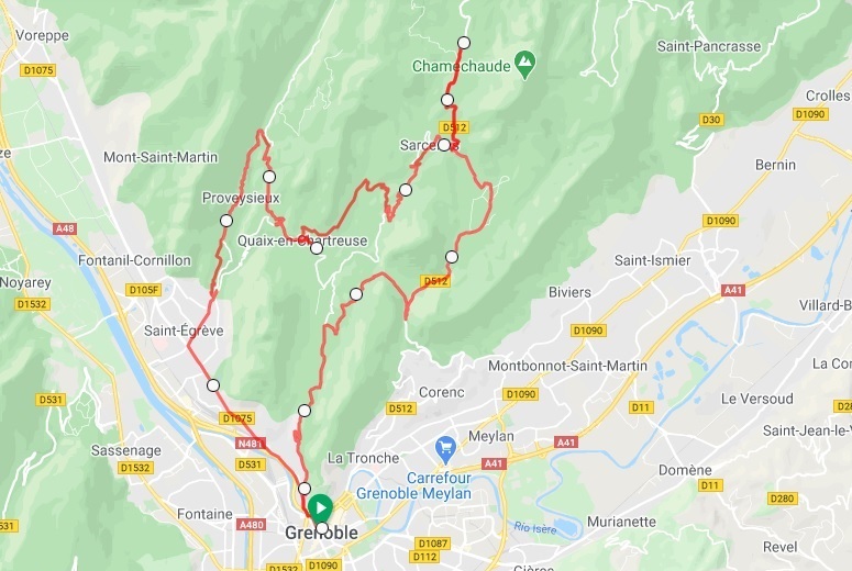
Grenoble also provides some good warm-up ride options immediately north of the city. Jump on your bike from the town centre and head out towards Saint-Egreve. Once you turn right you find yourself climbing up into the Massif Chartreuse-Tourisme. Just like the the 2020 edition of the Criterium du Dauphine follow the road to Sarcenas and up onto Col de Porte. Stage 16 of the 2020 Tour de France also used the Saint Nizier climb (11km at 6.5% average grade). This is a beautiful climb from Seyssins (Grenoble suburb) up to Villard-de-Lans.
La Prise de la Bastille
La Prise de la Bastille is one of the shortest bike races going around. However, during September every year the 2km time trial to the top of the fort is conducted. Six switchbacks and 320m of elevation gain (16% average grade) with pinches at 25%. The world’s best take 7 minutes and the slowest 20 minutes so add this to your cycling challenge. Be sure to admire the views on the terrace of the Chez le Per’Gras restaurant once the lactic acid has settled!
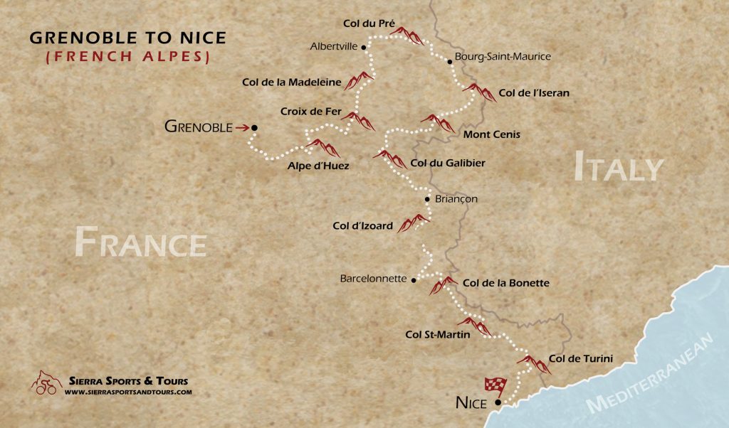
Starting in Grenoble also allows a north to south crossing of the Alps. Why might this be interesting? Well in our experience finishing a cycling challenge on the coast is our favourite way to end a cycling tour. In this instance Nice is a good option and why not enjoy some final days on the Cote d’Azur to celebrate your achievements. Here is an example cycling tour itinerary from Grenoble to Nice.
Le Bourg d’Oisans
It is true that everyone needs to cycle Alpe d’Huez at least once in their lifetime. But what many do not realise is that the Villard Reymond, Auris and Pas de la Confession balcony roads are simply jaw-dropping good. What is even better is that you do not need to move from Le Bourg to find these amazing roads. Other nearby towns such as Allemont, Oz and Vaujany are also good back-up options.
In addition to the famous TDF cols in the region Le Bourg is a great base thanks to a number of lesser known cols. The road cycling experience on the following climbs typically exceed the expectations of most cyclists. Col d’Ornon, Col de la Sarenne, Col du Solude, Col du Sabot and Montee de la Berarde after Saint-Christophe-en-Berarde.
‘Le Bourg’ – more than Alpe d’Huez
Col de la Sarenne
- From Le Bourg we like to find Col de la Sarenne via Auris. This means climbing the tough first km of Alpe d’Huez before turning right. To get things going we have what’s best described as a lumpy 20km to the base of ‘Sarenne’. What a remarkable balcony road. The following 15km climb to Sarenne need to be respected as it has ≥ 10% ramps in places and will be a huge test. The trade-off though is cycling through the beautiful Ferrand valley. The final hairpins take you up to 1999m elevation (yes 1999m!). Now you have a final easy 9km to the Alpe d’Huez ski village.
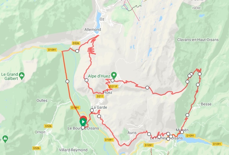
Col de Solude
- The climb rises out of Le Bourg d’Oisans. It is asphalted for the most part once you have past Villard notre Dame. It also includes a few unsealed sections for the gravel grinders. The road is ridable but for road bikes we only recommend cycling the route following this direction. From Villard Reymond enjoy the views across the valley to the Alpe d’Huez ski station. If you have already ridden Alpe d’Huez then the sense of satisfaction of what you have achieved will be at an all time high! To complete the loop back to Le Bourg d’Oisans first descend back down to Ornon. If you still have some legs Col d’Ornon is now waiting!
Pas de la Confesion
- From the Alpe d’Huez ski station the ride follows a small backroad. This road initially descends, later slightly rises, hugs the edge of the mountain and then provides spectacular views down to the valley floor. You will need to pass Switchback 5 and then look for the right hand turn off. After 2km of cycling you will reach the balcony lookout and Pas de la Confesion. Once back down in the valley there are many ride options from Allemont. Glandon, Croix de Fer, Col du Sabot and Col d’Ornon are all available. Otherwise simply head back along the bike lane back to the base of Alpe d’Huez.
Col du Sabot
- If you love cycling challenges then look no further than Col du Sabot. This 14.5km climb (1290m elevation gain at 8.9% average grade) is a real surprise packet. The climb goes higher than Alpe d’Huez (2100m compared to 1860m). It is also harder (1.5km longer and steeper). In addition it is surrounded by nature and has only a handful of cars. Just saying….
St Jean du Maurienne
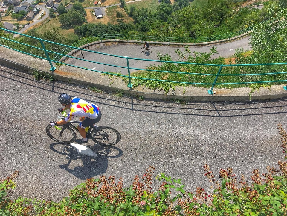
Within a few kilometres of the town centre there are many climb options. For example, Col du Glandon, Col de la Croix de Fer, Lacets de Montvernier, Col du Chaussy and Col du Mollard. Lacets de Montvernier is a climb that has not yet been discussed. While it is not overly difficult the chance to ride Lacets de Montvernier is truly memorable. This short but spectacular climb has only been used in the 2015 and 2018 Tour de France editions. 18 tight switchbacks (‘lacets’ in French) wind up over 3.5km creating a simply incredible cycling experience. Remember: the mythical Alpe d´Huez has 21 switchbacks over 13km!! Once we are all photo’d out the route can continue from the first cross road after the summit. Turn left and you are now on Col du Chaussy. Head right and you can head straight back down to St Jean du Maurienne.
Col de la Madeleine
For those who turned left Col du Chaussy includes a further 9km with approximately 750m of elevation gain. Another narrow balcony road awaits where two vehicles cannot pass in places. But it is a wonderful cycling experience for those who are not afraid of heights. To keep the chance for linking cols alive and it is even possible to ride from the Chaussy summit over to Col de la Madeleine. This would be an extra 25km following the D99 and D213 roads.
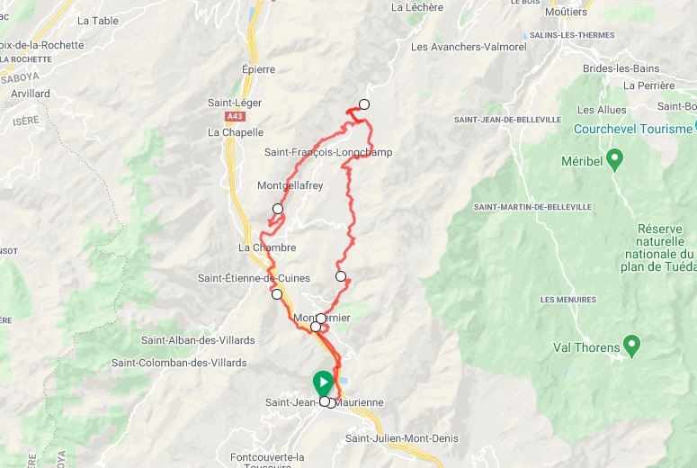
Telegraphe & Galibier Double
From St Jean du Maurienne it is also only 14km to the base of the Col du Telegraphe and Col du Galibier double. It is another long haul up the valley floor which is taxing. There is also lots of traffic so we typically recommend starting the Telegraphe climb from St Michel du Maurienne. We have cycled many times from St Michel down to St Jean though. There is usually a good shoulder and being all downhill the 14km are ridden pretty quickly.
In addition, if you drive 1hr from St Jean du Maurienne towards the French/Italian border you can stay in Lanslebourg which is discussed later.
Briancon
The historical centre of Briancon was built in the 17th Century. Its steep and narrow streets are a UNESCO World Heritage site. Thanks to its history, fortifications and cycling on offer it is a great base for French Alps cycling holidays. Briançon at 1326m elevation is also categorised as the highest town in France.
The region surrounding Briancon includes the following climbs; Col de Montgenevre, Col du Lauteret, Col du Granon and Col d’Izoard. On the south side of Col d’Izoard the Col du Vars and Col dell’Agnello climbs are also possible. However, tackling these rides from Briancon will be a big day and we recommend some help with a support vehicle.
Col du Granon from Briancon
One of the toughest climbs in the French Alps based on the stats would have to be Col du Granon. This 11.5km climb averages 9% and offers glacier views above the Massif des Ecrins peaks. The col has only been used as a summit finish during the 1986 Tour de France. With the race getting bigger and bigger there is not enough space at the top. So the logistics seem to be too difficult now for the race organisers. At the top road is a dead-end so the traffic is limited meaning more of the spectacular mountain views for you.
The final advantage for tired cyclists are the local thermal baths. Be sure to pack your bathers (no boardshorts) and swim cap (mandatory in France). Now you can let the warm waters revitalise your muscles. This is the best way to guarantee free Watts for your future rides! It doesn’t have to be all about cycling the French Alps!
Barcelonette
Barcelonette is a small town with only a few thousand inhabitants. It is steeped in Tour de France history. Col de Vars, Col de la Bonette, Pra Loup, Col d’Allos, Col des Champs and Col de la Cayolle are our favourite local climbs. It is very easy to spend a few days here. There is also a strong Mexican heritage in town which brings something different to the table!
Col de la Bonette for most is the major drawcard for cyclists looking for a cycling challenge. At 2802m altitude it is the highest asphalted road in France. The extra loop up to the car park means it leapfrogs just slightly ahead of Col de l’Iseran. Perhaps a rivalry for bragging rights does really exist in the French Alps after all! Cycling from Barcelonette means your legs get an important 10km warm up to the base of the Bonette. This 24km climb averages 7% and is a constant climb that rarely gets too steep. Let the switchbacks take you up into what is an expansive alpine landscape. Being so far above the tree line means the views are awesome!
One of Europe’s best loop rides
The region is also home to one of the best loop rides in Europe. Most cycling enthusiasts have heard of the famous Sella Ronda loop in the Italian Dolomites. Yet most have possibly never heard of this Maritime Alps beauty. This French Alps loop includes Col d’Allos, Col des Champs and Col de la Cayolle. At 100km long it’s almost double the Sella Ronda distance. With 3000+m elevation it also boasts an extra 1250m of elevation gain.
All three peaks also soar above 2000m elevation and include beautiful river valleys and scenic mountain roads. Col de la Cayolle is a real favourite of ours. It is probably the toughest climb when approached from the south (20.5km at 6.3% average grade). Tour de France history is also at every switchback with three race crossings for Col de la Cayolle and nine crossings for Col d’Allos.
For those who love TDF history then the climb to nearby Pra Loup will be a must ride. This was the finish for the epic 1975 Tour de France stage where Bernard Thévenet cracked the legendary Eddie Merckx (5 x TDF champion)!
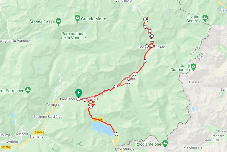
Lanslebourg
Lanslebourg is a ski village located near the France/Italy border. Col de l’Iseran is number 1 on the list of Europe’s highest passes and a must for all recreational cyclists. However, Mont Cenis has also been a strategic crossing between France and Italy for thousands of years. The road rises up from this small town. To cap it off Mont Cenis has 5 x Tour de France appearances (3 from this French side). The 2013 Giro d’Italia created an amazing stage where the peloton scaled both sides! From Lanslebourg the Mont Cenis climb is 10km up towards the Italian border at 7% average grade. The mountain roads either side of the summit are cycling paradise!
Lanslebourg is a fantastic base because it also allows you to easily cycle into the Maurienne valley. So what does this mean for recreational cyclists who now have Iseran and Mont Cenis on their cycling CV? Col du Telegraphe and Col du Galibier double are now in striking distance! The first 45km are mostly downhill to the base of Telegraphe. But we also like to make sure we get off the main road and include Montee d’Aussois and Cote de Saint Andre. Both are 3km climbs at around 6% average grade and provide the perfect chance to get the legs going before a classic TDF double.
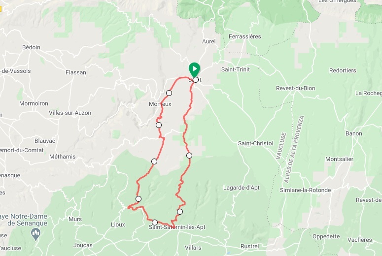
Bedoin
The cycling around the Mont Ventoux region of Provence combines breathtaking scenery. There are also challenging climbs, awesome descents and the quiet backroad experience. Combine your Ventoux cycling adventure with towns and places such as Sault, Gordes, Rousillon and Gorges de la Nesque. Now an excellent French Alps cycling holiday awaits! Bedoin is also a charming town and usually from May to October the Monday morning farmer’s market is a sight to see.
Final Words from Cycling the French Alps
The weather when cycling the French Alps always needs to be carefully assessed. Early June to mid-October every year is typically a good ballpark for col collecting. However, there is nothing set in stone as it is still very much a season to season proposition.
Always consider the summit elevation. The cycling season is usually a few weeks longer in total for cols with elevations between 1500-2000m compared to those between 2250-2750m. Be sure to give this some serious consideration if a giant mountain pass like Col de l’seran or Col du Galibier is on your hit-list. At the same time in the hautes alpes (high alps) the weather during the peak of summer can change from one extreme to another daily. Always come prepared with the appropriate cycling gear especially if you will be riding without a support vehicle.
Are you now ready for some cycling in the French Alps? We hope you have found our guide to cycling the French Alps useful. If you have any questions regarding the famous ‘cols’ on offer please feel free to Contact Us and we will be pleased to assist.
Plus if you would like to join us on tour in the future then please check out our detailed Epic French Alps cycling tour itinerary.
Additional Cycling Blogs
Other cycling guides that may be of interest include Cycling the Italian Alps and our French Pyrenees blogs.
In addtion, take some time to go through our tips for ‘How to get the best out of your next European cycling holiday‘.