
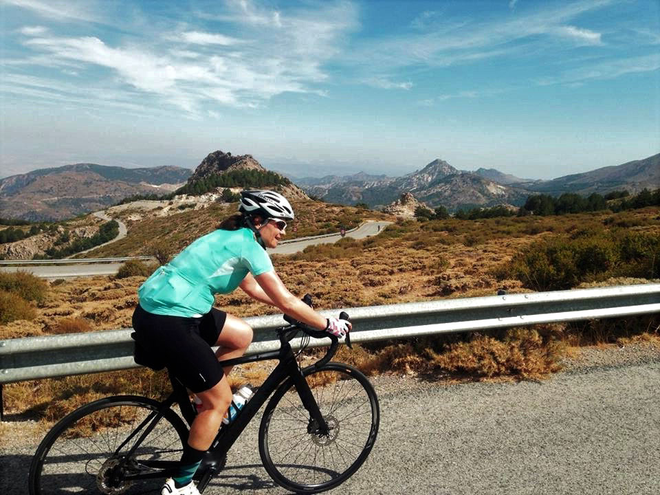
Located deep within the Sierra Nevada mountain range in southern Spain is the towering summit of Veleta (Pico de Veleta). Veleta is the highest asphalted road in Europe and the cycling experience is challenging, unrelenting and rewarding to say the least.
The Veleta peak sits at 3392m elevation however the asphalted road finishes at approximately 3300m altitude. After 40km of road bike climbing the final kilometre turns to gravel which is best for mountain bikes. For this reason, I usually make sure to carry a small backpack with some running shoes to walk the final section up to the Veleta summit. On a clear day you don’t want to miss the spectacular views down to the Mediterranean Sea after getting so close to this monumental European peak!
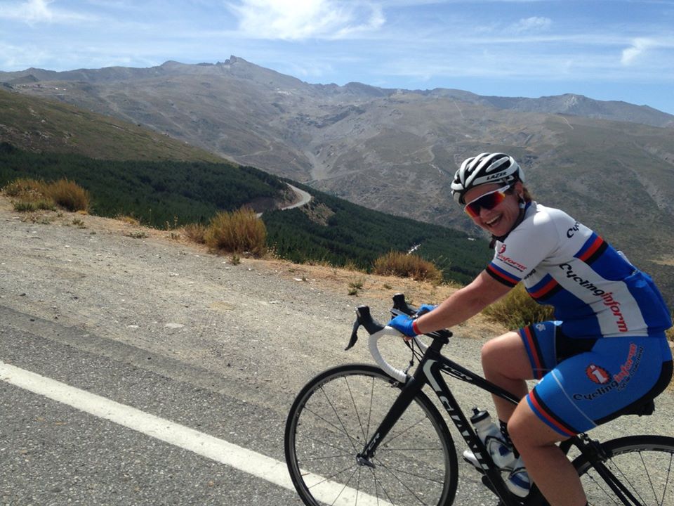
When contemplating this cycling challenge it is always interesting to note that Veleta is more than 500m higher than either Col de l’Iseran (Cycling in the French Alps) or Stelvio Pass (Cycling in the Italian Alps) which is really saying something. Cadel Evans during his years with Team Silence-Lotto used Sierra Nevada in Andalusia as his altitude training base on multiple occasions and these mountains were considered the secret weapon for a number of his TDF campaigns.
The road to Pico de Veleta – which way up?
From Granada which sits at 765m elevation there are 6 main ascents of varying difficulty up to the Sierra Nevada ski village (Pradollano at 2390m elevation). All are perfect for road cycling and in no particular order include:
- 1. Exit the town Cenes de la Vega on the outskirts of Granada and follow the main road (A395) all the way up to Pradollano ski station. This is the most straightforward route but also the climb with the most traffic. There is always a pretty good shoulder and cyclists are a very common feature so it is still a pretty good option.
- 2. Exit the town Pinos Genil, continue climbing on the A4026 road before joining the A395 and continuing towards Pradollano ski station. This option remove approximately 4km on the main Sierra Nevada ski station road.
- 3. Ride from Cenes de la Vega to Guejar Sierra. From Guejar Sierra follow the narrow road past the old Hotel del Duque and later join the Haza Llanas climb (see Option 4 below). At the top of Haza Llanas you are now close to the Sierra Nevada tourist centre (El Dornajo). This detour on the very old road to Hotel del Duque gets the climb started with nearly 5km at 9% average grade. It is the old road so it is very narrow so we recommend only climbing this section. You don’t want to get a surprise on a corner descending too quickly!
- 4. Ride from Cenes de la Vega to Guejar Sierra and look for the GR3200 road. This will take you over the river Rio Genil and up the terrifying Haza Llanas climb. ‘Haza Llanas’ as just mentioned finishes near the Sierra Nevada tourist centre on the A395 up to Pradollano ski station.
- 5. Begin from the sleepy Monachil township and follow the GR3202 road up what is referred to as the ‘El Purche’ climb. A favourite section for the professional cyclists as this mountain backroad is a tough slog and also hidden away from the main traffic. After 9km this ascent also links up with the A395 towards Pradollano. Follow this blog through to the end to find out more about Monachil and El Purche!
- 6. Along the A395 you will find the Sierra Nevada tourist information centre ‘El Dornajo’. Following Option 1 you can continue all the way to Pradollano or you can also decide to veer left onto the secondary A4025 road (Collado de las Sabinas climb). The Sabinas climb at the top takes you through to the Pradollano ski station where it meets the main road again (A395).
Once you have pedalled your way into Pradollano ski station it is always a good spot to have a short break or lunch to gain strength for what still remains. Perhaps a small plate of paella? Follow this link for our very own Spanish paella recipe! From Pradollano you need to remember you have already climbed for approximately 25km and 1500m elevation gain. From Pradollano there is still over 1100m of elevation gain required before even reaching Pico de Veleta.
Assault Veleta!
This ride report focuses on the Haza Llanas and Sabinas climb combination to Pradollano (Options 4 and 6 respectively) before taking it all the way to Pico de Veleta. This ascent is really three climbs in one and has so much La Vuelta a Andalucia (Ruta del Sol) and La Vuelta a España (Tour of Spain) history. It is also on very quiet backroads making it a real pleasure and ‘struggle’ all at the same time. Just so you know, we rated this ride loop as Number 6 in our Top 10 Best European Cycling Loop Rides.
Rising from the valley floor is probably a strange way to describe it when you are already nearly at 800m altitude but the ride does in fact begin on the valley floor out of Granada. Before setting off we decide to bypass the modern highway and its ‘comfortable’ 6% gradient and head for one of the mountain back roads. On exiting Cenes de la Vega we look for the Guejar Sierra signposts and follow an undulating and winding road which hugs the impressive Canales reservoir. There is definitely more up than down here though as the ride out of Granda to Guejar already softens the legs with 235m of elevation gain. Guejar Sierra is a small, sleepy mountain village which offers an excellent base for outdoor hiking and biking adventures.
After entering the township and passing through its small streets we arrive at the base of the Haza Llanas climb. We quickly realise that the most daunting and difficult part of the whole climb is right at the beginning, well before the silhouette of Veleta and its vertical summit wall is even close to entering our line of vision. There is a small bridge crossing at the hydroelectric plant and another hard 90-degree right hand turn which hides the vicious initial ramp.
We had seen TV coverage of Alberto Contador and Chris Froome challenging each other during Stage 3 of the 2015 Vuelta a Andalucia road race so luckily we already knew after the technical descent and bridge crossing that we needed to be in the small chainring!! The first 3km, the hardest of the ascent, include seven spectacular switchbacks with an average grade of around 11% and sections in some curves above the 15% grade. After about 5km the road eases slightly and continues on at a more realistic angle climbing up at 5-6%.
Once at the top of Haza Llanas you have experienced 7km with an average grade of 9.5%. As you can see, it is a serious test! Perhaps not quite in the same league as Zoncolan or Mortirolo in the Italian Alps but at the same time a name that you will definitely not forget in a hurry.
From the Haza Llanas summit you come to a T-intersection with the A-4025 and by turning left you are officially on the Collado de las Sabinas climb. Note: if you turn right you are only a few hundred metres from the El Dornajo tourist centre on the main road. But we recommend the left-hand turn onto ‘Sabinas’ which climbs for 8km (6.5% average grade) and still takes you directly to the Pradollano ski station but away from all of the traffic. After around 5km of climbing on the A-4025 the road presents us with a new feast of switchbacks; a total of twelve in the next 6km to be precise taking us to 2000m altitude.
It is during this second section of endless switchbacks that we catch our first glimpse of the vertical wall which defines Pico de Veleta in front of us. We also use this time to look back on where we have ridden from and the fantastic switchbacks also offer sweeping views back down towards Granada. We are quickly snapped out of our reverie by the realisation that only half the job has been done and we are still far from the Veleta peak. By comparison, even in the Pyrenees, French Alps or Dolomites for that matter, the effort so far would have been enough to reach the top of most famous mountain passes.
Here though one must be patient if one is to climb the remaining 1300m of elevation gain to reach the Veleta summit. At the same time we also need to pinch ourselves that this is actually the old road to the ski station. Que calidad!

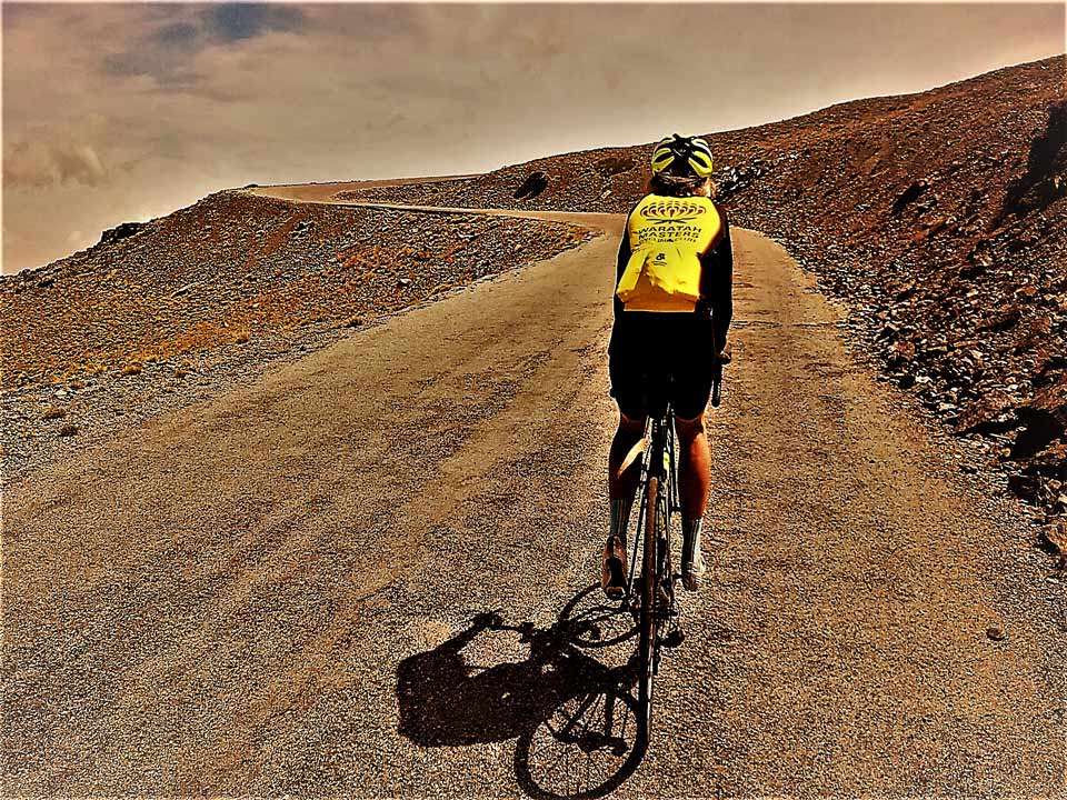
On arrival to Pradollano ski station most local cyclists have done their training for the day, take their customary photo, zip up their vest or jacket and turn around for the long, fun and fast descent back to Granada. But for the altitude junkies out there looking to pass 3000+m altitude we mush push on for another 6km up to the military barrier (Hoya de la Mora zone). Hoya de la Mora is near the 2500m altitude signpost and another place to regroup as it sits just below the military barrier preventing vehicles from passing. Only walkers and cyclists from here which means one can ride without traffic for a further 12km up to the ‘Pico de Veleta´ summit.
Groups of cyclists often have a support vehicle waiting in the Hoya de la Mora car park for restocking food and drink, handing over a small backpack with extra gear, etc, etc. There have been days in June /July where the temperature here is 10-15 degrees C while down in Granada it is reaching 35 degrees. I have even seen some groups carry a couple of portable oxygen cans into their backpacks should the 65% of normal oxygen levels create altitude sickness.
Personally, a major drawcard for climbing Veleta is that the final section of road is guarded by a military barrier that prohibits the passage of civilian vehicles. As you gaze into the distance and towards the sheer vertical rock wall which characterises Pico de Veleta you cannot help but marvel at the engineering feat that enabled you to tackle this ultimate cycling challenge. This is now a mountain road in every sense. Only 12km and 850m of further altitude gain separates you from cycling heaven!
From the military barrier the hairpins continue at an alarming rate and the slope hovers at 7 – 8%. In some places, too, the road twists tightly and rises into double digits. These steep pinches, whilst short in length, inflict considerable damage as the continuous effort and the lower oxygen levels at these altitudes take their toll. At this point the 2750m altitude signpost is reached and received with joy and great emotion. Its sandblasted condition is testimony to the severe mountain conditions that batter this area during winter.
It is here you take the opportunity to take stock of your achievement to date. You are around the elevation and sharing company with some of the famous mountain passes such as Gavia, Galibier, Stelvio, Agnello, Iseran or Bonette which are the authentic myths of our cycling sport. We pay our respect to these climbs but appreciate that with over 500m of elevation gain still awaiting us the challenge is still in front of us!
Adding to this challenge is the vagaries that snowfalls can present to the aspiring rider. Depending on the season it is not uncommon to find fields of ice strewn across the road. As we pass the magical figure of 3000m altitude we pass a ravine and still during late June we uncover walls of snow up to 3m high in places. On this occasion we are lucky indeed as we follow alongside the ice walls for a few hundred metres with no sign of snow. The air is crisp through this section, the early summer sun hidden behind towering peaks and a chill enters the numbing body.
Road Cycling Heaven
From 3100m altitude we swing around a hairpin to the right and as our eyes lift from the road we come across the completely vertical wall of Veleta: “We still have to rise more? But how much more? It seems to be further away than before!” The asphalt has now become weathered through years of freeze/thaw action and as we enter the last hairpin it disappears and the final authentic wall is all that remains.
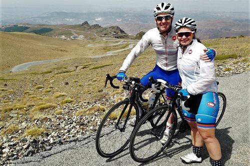
The last ramp is possible on a mountain bike but seeing I usually ride a road bike I decide to change my shoes here and scale the final metres up to the 3392m survey column by foot. Resting at the survey column my exhaustion disappears and a sense of exhilaration takes hold as it now dawns on me that that this beast of a mountain has been conquered. We find ourselves in the highest point than can be reached by road bike on the European continent. The effort was definitely worth it!!!
The Pico de Veleta climb really has everything that the hardened cycling aficionado might want: a 40km continuous climb, an altitude gain of approximately 2650m and an average grade of 6.5%. No wonder this unique cycling ascent is known as ‘The Everest of European Mountain Passes’.
Windy like Mont Ventoux
When riding above 3000m elevation the wind is something that needs to be carefully assessed when cycling up Pico de Veleta. The final 12km are barren and wind gusts can be an unwanted surprise when rounding the various switchbacks.
Much like Mont Ventoux, aka Le Geant de Provence, there will be occasions when the wind tops 100km/hr near the summit. I have never had a problem with the wind when riding to the 2500m mark at Hoya de la Mora but on one occasion I did need to abort my ride not long after the military barrier. When my bike moved 2m across the road for the third time I decided that that was enough! Considering though that I have attempted to ride to the top of Veleta on five occasions (between June and September) and have only failed once the chances are you will be able to ride to all the way if you choose one of the late spring or summer months.
If the wind does seem to be causing issues for you after the military barrier then there is still another climb option to assess before retreating to the lower Pradollano ski station area. Still above the military barrier is a turn off to IRAM one of Europe’s biggest satellites which sits at 2845m elevation.
Venturing off into this corner of the Sierra Nevada mountain might provide the necessary protection from the wind and allow you to ride up to this impressive satellite with a 30m diameter. The latest claim for fame from the IRAM satellite was producing the first real photo of a black hole during April 2019. The next piece of history we are now waiting for is a La Vuelta a España stage summit finish up to IRAM. There has been some talk of this happening and we will be there for sure if the scenario ever eventuates!
El Purche in Monachil, Granada
When writing about road cycling in the Sierra Nevada mountains one cannot miss the opportunity to talk about Monachil and ‘El Purche’ climb. If you go riding during May and June every year then you will typically find riders from Cofidis, Quickstep and Movistar to name a few professional cycling teams training for the Tour de France on ‘El Purche’ segment. It has been quite a buzz over the years riding alongside riders of the calibre such as Philippe Gilbert and Bob Jungels and even getting the wave from Alejandro Valverde as he speeds around one of the switchbacks.
One day I was even testing an electric road bike on part of this climb and I was joined by Luis Angel Mate from Cofidis. Riding alongside a professional cyclist who was doing his hill repeats, having a quick chat, while I was riding an e-bike drilled home just how good these pro-riders are!
The Monachil township is about 10km from central Granada and a sleepy hangout. There is the chance for a coffee stop before getting started or even a beer post ride depending on your preferences. As you exit the town the first switchback warns you off what is now to come. There are approximately 7km at 8.5% average grade up to El Purche camping area. Considering the first km out of the town is 2.5% grade the real numbers are six consecutive kilometres at 9.5% average grade. Combined with the fact that there is hardly any traffic, the technical nature of the climb/descent and the chance to ride hill repeats away from what can sometimes be the negative effects of high altitude (live high, train low concept) it is easy to see why the professional riders call ‘El Purche’ home.
Just like the Option 4 / Haza Llanas climb this straight up test from the Granada valley floor is a tough way to get your 40km climb to Pico de Veleta started! Also, coming back to that race when Contador and Froome contested a magical day in the Sierra Nevada mountains. It was late February 2015 so the Pradollano ski village was still in full swing, however, that didn`t dampen the spirits of the Ruta del Sol race organisers. The closing kilometres of the stage included the tough climb to El Purche from Monachil before descending down the main road to Granada and then the final test to Haza Llanas. The stage never got above 1500m elevation and was as hard a day as the peloton could ever imagine especially at such an early time in their season.
If you are interested in checking out the Sierra Nevada region first-hand then we have a private Route of the Caliphate cycling tour suggestion which begins in Granada and finishes in Cordoba. There you go for two fantastic travel destinations through Andalusia which also allow some great road bike adventures!
Links to other interesting reads in our latest Road Cycling series include:
Cycling with TDF Royalty – Miguel Indurain
Top 10 Best European Cycling Loop Rides
Pyrenees Cycling Web-Guide (coming soon – January 2021)